
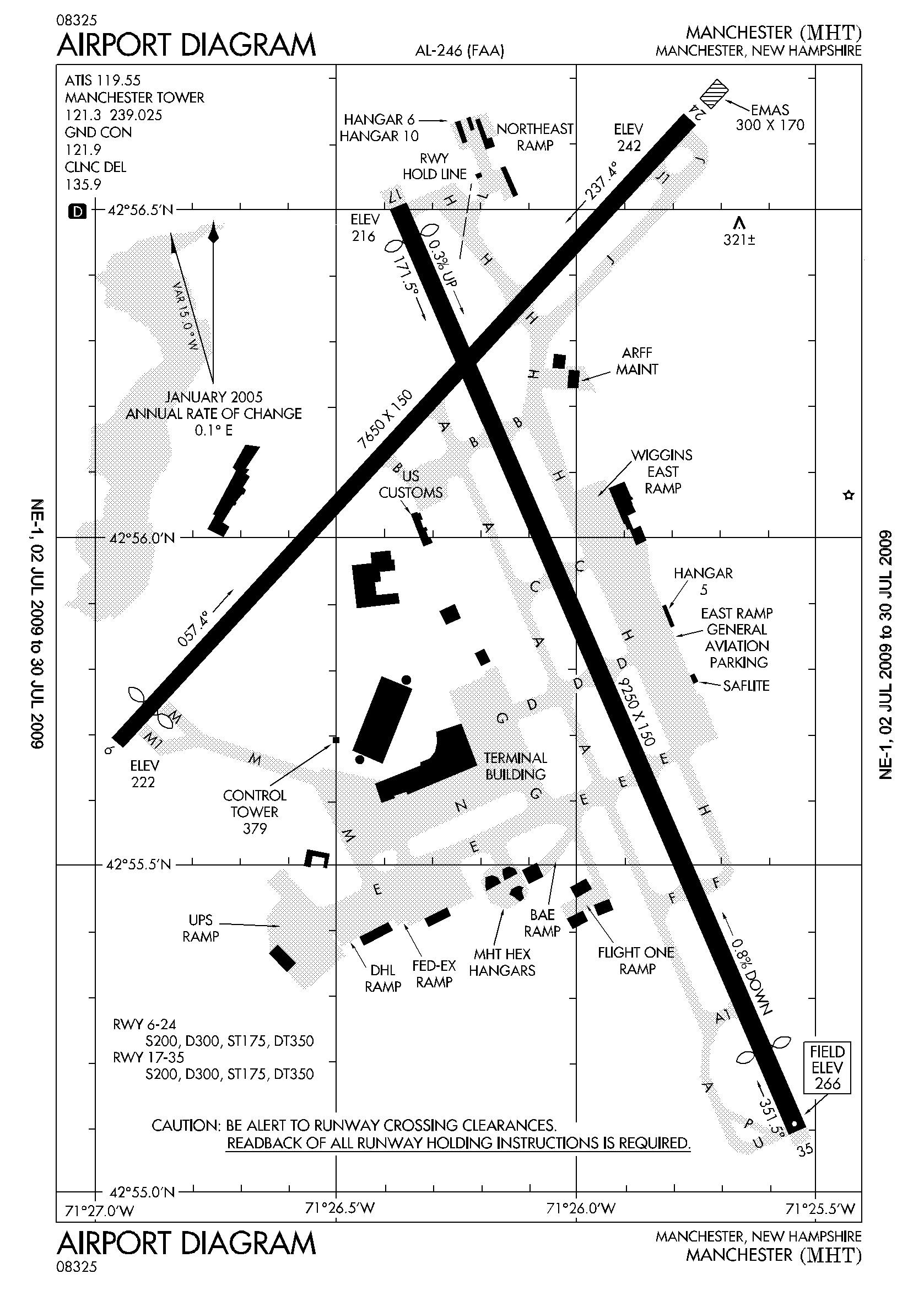
Image: KMHT Airport Diagram Large
Size of this preview: 430 × 600 pixels. Other resolutions: 172 × 240 pixels | 1,677 × 2,340 pixels.
Original image (1,677 × 2,340 pixels, file size: 53 KB, MIME type: image/png)
Description: Manchester airport diagram
Title: KMHT Airport Diagram Large
Credit: http://flightaware.com/resources/airport/MHT/APD/AIRPORT+DIAGRAM/pdf
Author: Produced by the National Aeronautical Charting Office (NACO), a department of the Federal Aviation Administration (FAA)
Permission: This image or file is a work of a Federal Aviation Administration employee, taken or made as part of that person's official duties. As a work of the U.S. federal government, the image is in the public domain in the United States.
Usage Terms: Public domain
License: Public domain
Attribution Required?: No
Image usage
The following page links to this image:

All content from Kiddle encyclopedia articles (including the article images and facts) can be freely used under Attribution-ShareAlike license, unless stated otherwise.