
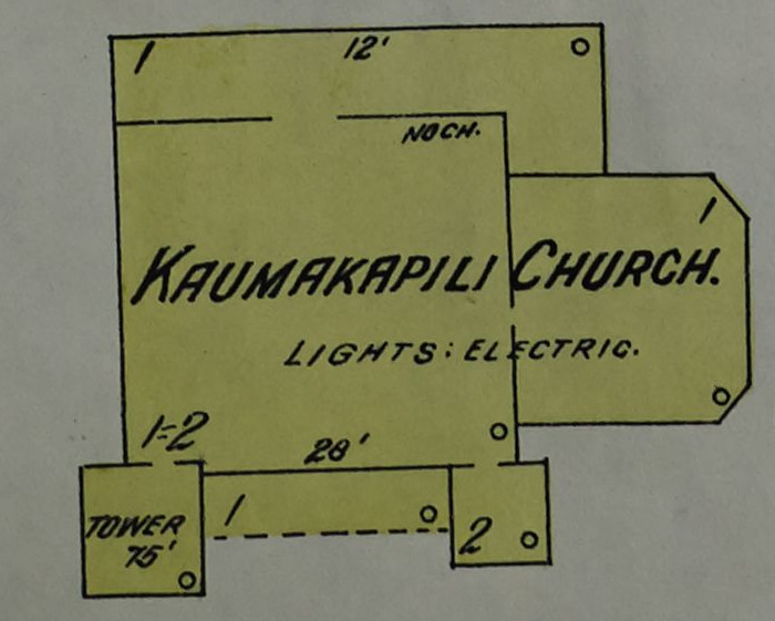
Image: Kaumakapili Church in 1914 detail, Sanborn Fire Insurance Map from Honolulu, Oahu County, Hawaii. LOC sanborn01537 001-12 (cropped)
No higher resolution available.
Kaumakapili_Church_in_1914_detail,_Sanborn_Fire_Insurance_Map_from_Honolulu,_Oahu_County,_Hawaii._LOC_sanborn01537_001-12_(cropped).tif (700 × 561 pixels, file size: 1.12 MB, MIME type: image/tiff)
Description: 1914. 126 Sheet(s). Map of congested district. Bound.
Title: Kaumakapili Church in 1914 detail, Sanborn Fire Insurance Map from Honolulu, Oahu County, Hawaii. LOC sanborn01537 001-12 (cropped)
Credit: https://www.loc.gov/item/sanborn01537_001/
Author: Unknown authorUnknown author
Permission: This map is available from the United States Library of Congress's Geography & Map Division under the digital ID g4384hm.g015371914. This tag does not indicate the copyright status of the attached work. A normal copyright tag is still required. See Commons:Licensing for more information.
Usage Terms: Public domain
License: Public domain
Attribution Required?: No
Image usage
The following page links to this image:

All content from Kiddle encyclopedia articles (including the article images and facts) can be freely used under Attribution-ShareAlike license, unless stated otherwise.