
Image: Kent Island Queenstown Maryland 1775

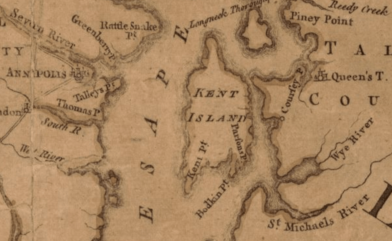
Description: This 1775 map shows the area near Kent Island, Province of Maryland including Queenstown (to the east) and Annapolis (west across the Chesapeake Bay). The Catholic community around Queenstown, established in the 1640s, was the first on Maryland’s eastern shore.
Title: Kent Island Queenstown Maryland 1775
Credit: This is a portion of a 1775 map created for Robert Sayer in London. The entire map can be found in the Library of Congress and shows the most inhabited part of Virginia containing the whole province of Maryland with part of “Pensilvania”, New Jersey and North Carolina. map
Author: Joshua Fry, Peter Jefferson, Robert Sayer, Thomas Jeffrys
Usage Terms: Public domain
License: Public domain
Attribution Required?: No
Image usage
The following page links to this image:
