
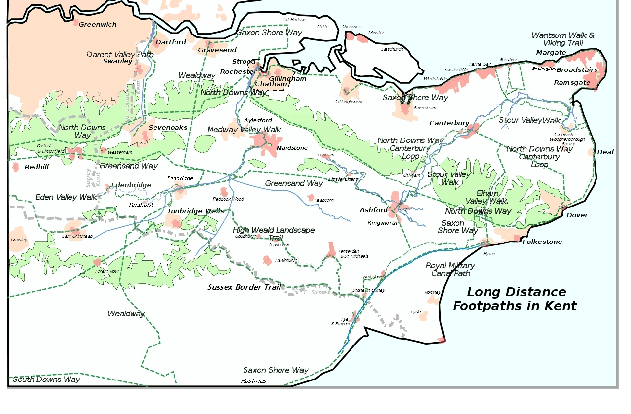
Image: Kent Long Distance Footpaths
Description: Adapted from User:ClemRutter who in 2007 produced a less detailed map of all the long distance footpaths in Kent in 2007 this 2012 has the Sussex Border Path and omits the London Circular and Vanguard paths for only a tiny % being in the Kent. Inspired by Jessop, Kent History Illustrated, with details from the KCC Public transport Map 2006/2007. There will be inaccuracies where paths join, or run parallel to a feature that was symbolic on the base map. Please inform me of serious errors and omissions via my Talk page. Constructed using Inkscape 0.45.1, so there may be rendering problems. Version 1 chose yellow for the path, it was great on the screen, but bad on the printer. I had used yellow because it follows the Yellow Arrow on the Waymarkers. This version uses dark green and changes the font so it is easier to read when rendered into a png. The Rivers are now blue. The spelling mistake in the name has been corrected.
Title: Kent Long Distance Footpaths
Credit: Wikimedia Commons
Author: Clem Rutter
Permission: see
Usage Terms: GNU Free Documentation License
License: GFDL
License Link: http://www.gnu.org/copyleft/fdl.html
Attribution Required?: Yes
Image usage
The following 3 pages link to this image:
