
Image: Kent Wards 2022

Size of this PNG preview of this SVG file: 616 × 600 pixels. Other resolution: 247 × 240 pixels.
Original image (SVG file, nominally 1,499 × 1,459 pixels, file size: 2.04 MB)
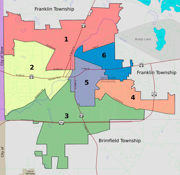
Description: Map of Kent, Ohio, showing the ward boundaries as of 2022. Base map comes from the 2024 Boundary and Annexation Survey Map with labels added.
Title: Kent Wards 2022
Credit: Own work
Author: JonRidinger
Usage Terms: Creative Commons Attribution 4.0
License: CC BY 4.0
License Link: https://creativecommons.org/licenses/by/4.0
Attribution Required?: Yes
Image usage
The following page links to this image:

All content from Kiddle encyclopedia articles (including the article images and facts) can be freely used under Attribution-ShareAlike license, unless stated otherwise.