
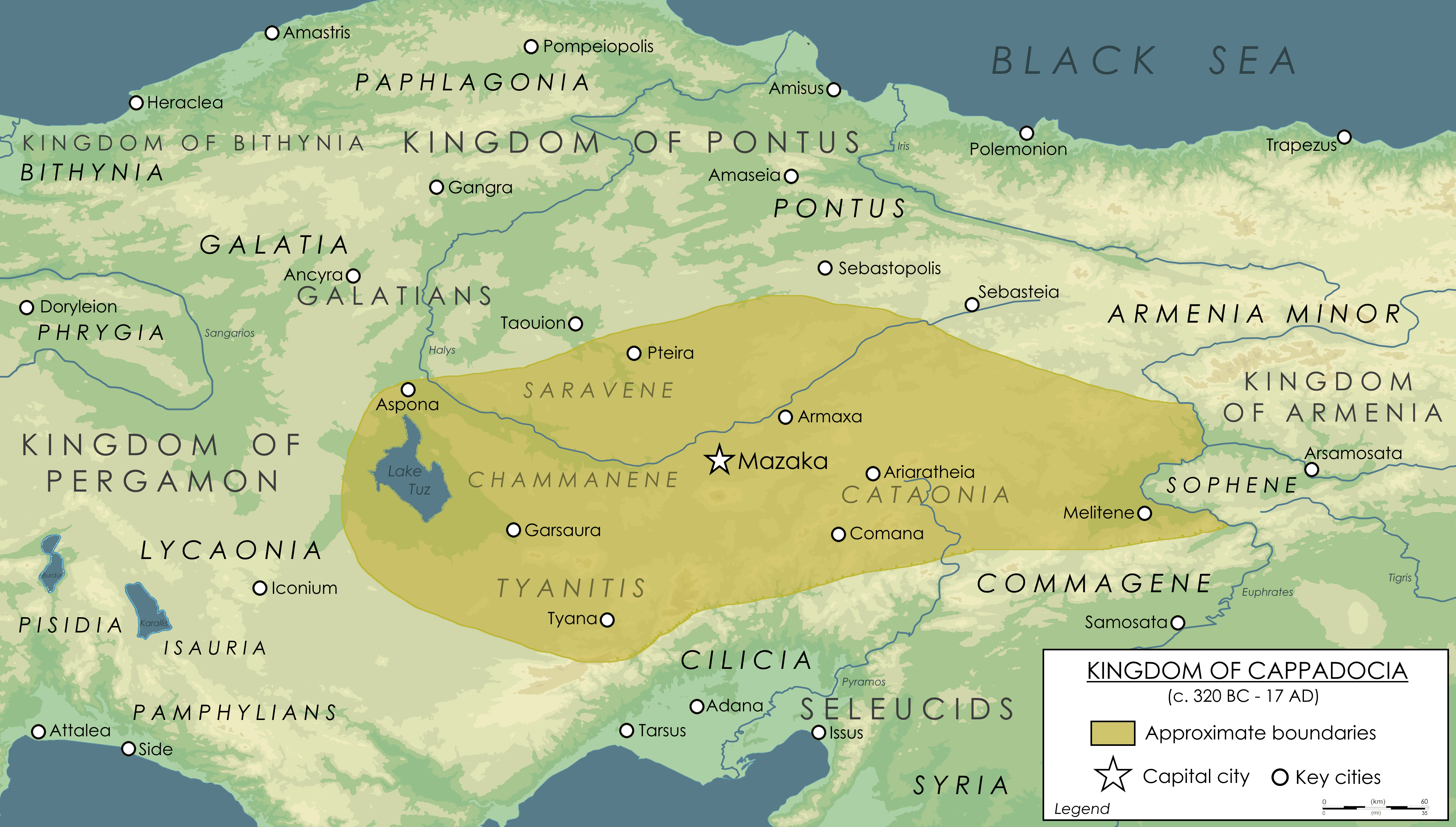
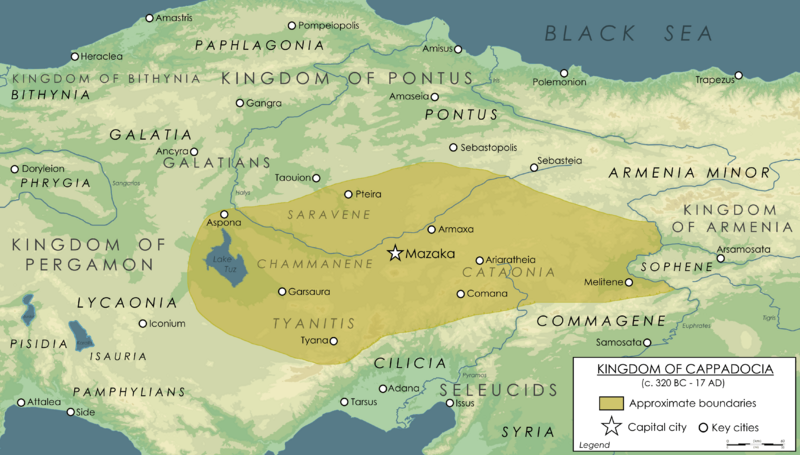
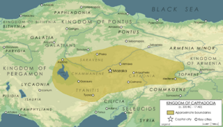
Image: Kingdom of Cappadocia
Description: Map showing the Kingdom of Cappadocia at it's peak during the reign of Ariarathes V (163-130 BC). Boundaries are based on various researches that includes different Wiki articles with their sources. Alongside with other maps that displays Hellenistic Period in Anatolia. Such as https://commons.wikimedia.org/wiki/File:The_Hellenistic_World_in_late_281_BC.png and https://commons.wikimedia.org/wiki/File:Hellenistic_world_and_Maurya_Empire_281_BCE.png This map so far roughly displays the boundaries of the realm around the year 130 BC with high histocial accuracy.
Title: Kingdom of Cappadocia
Credit: Own work
Author: Ennomus
Usage Terms: Creative Commons Attribution-Share Alike 4.0
License: CC BY-SA 4.0
License Link: https://creativecommons.org/licenses/by-sa/4.0
Attribution Required?: Yes
Image usage
The following page links to this image:
