
Image: Kingdom of the Isles, circa 1200 (png version) 02
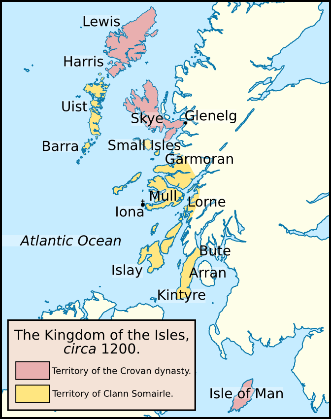
Description: Map of the Kingdom of the Isles in about 1200. The lands controlled by the Crovan dynasty are coloured red; the lands controlled by the descendants of Somerled (Clann Somairle) are coloured yellow. Locations displayed on this map include: the Atlantic Ocean, Arran, Barra, Bute, Garmoran, Glenelg, Harris, Iona, Islay, Isle of Man, Kintyre, Lewis, Lorne, Mull, Skye, the Small Isles, and Uist. I based this map off one published in the following book: McDonald, R.A. (2007). Manx Kingship in its Irish sea Setting, 1187–1229: King Rǫgnvaldr and the Crovan dynasty. Four Courts Press. 978-1-84682-047-2.
Title: Kingdom of the Isles, circa 1200 (png version) 02
Credit: Own work. I created this image using Inkscape. I used the following image, created by NordNordWest: File:United_Kingdom_location_map.svg.
Author: Brianann MacAmhlaidh
Permission: Brianann MacAmhlaidh, the copyright holder of this work, hereby publishes it under the following license:
Usage Terms: Creative Commons Attribution-Share Alike 3.0
License: CC BY-SA 3.0
License Link: https://creativecommons.org/licenses/by-sa/3.0
Attribution Required?: Yes
Image usage
The following 5 pages link to this image:

_02.png)