
Image: Klamath Basin map
Size of this preview: 631 × 600 pixels. Other resolutions: 252 × 240 pixels | 1,179 × 1,121 pixels.
Original image (1,179 × 1,121 pixels, file size: 1.92 MB, MIME type: image/png)
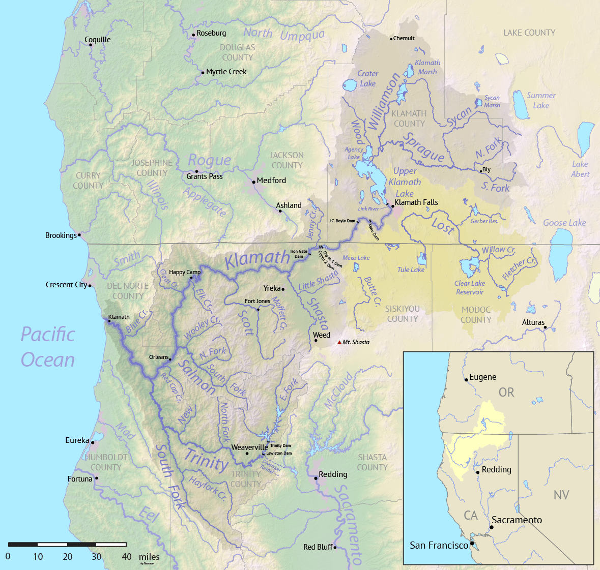
Description: Map of the Klamath River basin in California and Oregon, United States. Klamath watershed shown in gray. The intermittently connected Lost River and Butte Creek watersheds are shown in yellow. Made using public domain USGS National Map data.
Author: Shannon1
Usage Terms: Creative Commons Attribution-Share Alike 3.0
License: CC-BY-SA-3.0
License Link: http://creativecommons.org/licenses/by-sa/3.0/
Attribution Required?: Yes
Image usage
The following 2 pages link to this image:

All content from Kiddle encyclopedia articles (including the article images and facts) can be freely used under Attribution-ShareAlike license, unless stated otherwise.