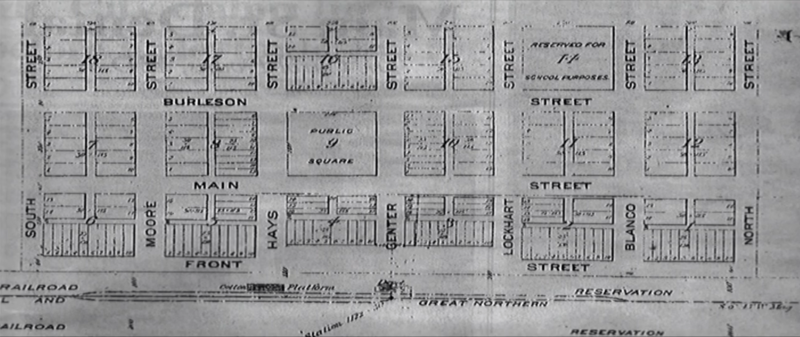
Image: Kyle Townsite Plat - 1880

Size of this preview: 800 × 337 pixels. Other resolutions: 320 × 135 pixels | 1,917 × 808 pixels.
Original image (1,917 × 808 pixels, file size: 1.05 MB, MIME type: image/png)
Description: The original street plat and plans for Kyle, TX following a 7 September 1880 survey. Includes the public square (now Mary Kyle Hartson Park), school designated block, railroad depot, and a cotton platform at the end of Center and Hays (now Miller) streets, respectively. Stockyards for cattle shipping would later be located south of South Street or off the left-hand side of the plat.
Title: Kyle Townsite Plat - 1880
Credit: Own work
Author: Anthellimus
Usage Terms: Creative Commons Attribution-Share Alike 4.0
License: CC BY-SA 4.0
License Link: https://creativecommons.org/licenses/by-sa/4.0
Attribution Required?: Yes
Image usage
The following page links to this image:

All content from Kiddle encyclopedia articles (including the article images and facts) can be freely used under Attribution-ShareAlike license, unless stated otherwise.
