
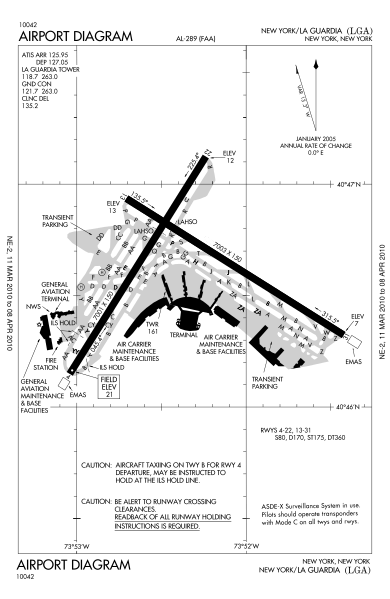
Image: LGA airport map

Size of this PNG preview of this SVG file: 390 × 599 pixels. Other resolution: 156 × 240 pixels.
Original image (SVG file, nominally 484 × 743 pixels, file size: 587 KB)
Description: FAA diagram of LaGuardia Airport.
Title: LGA airport map
Credit: http://204.108.4.16/d-tpp/1003/00289AD.PDF
Author: FAA
Usage Terms: Public domain
License: Public domain
Attribution Required?: No
Image usage
There are no pages that link to this image.

All content from Kiddle encyclopedia articles (including the article images and facts) can be freely used under Attribution-ShareAlike license, unless stated otherwise.