
Image: LIRR schematic

Size of this PNG preview of this SVG file: 800 × 339 pixels. Other resolution: 320 × 135 pixels.
Original image (SVG file, nominally 3,985 × 1,687 pixels, file size: 500 KB)
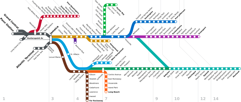
Description: Schematic diagram of the Long Island Rail Road system as of 2013, with numbering indicating fare zones. Lines are shown as indicated and named on the official LIRR map; in actual service trains often switch paths through Jamaica. The Lower Montauk Line, owned by the LIRR but now a New York and Atlantic Railway secondary, is shown with a thin dashed line.
Title: LIRR schematic
Credit: Own work
Author: Original map by User:NE2 with later modifications by users listed below
Usage Terms: Public domain
License: Public domain
Attribution Required?: No
Image usage
The following page links to this image:

All content from Kiddle encyclopedia articles (including the article images and facts) can be freely used under Attribution-ShareAlike license, unless stated otherwise.