
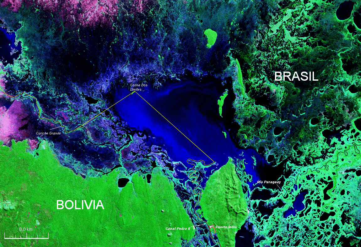
Image: Laguna Uberaba División Bolivia Brasil Satellite map
Size of this preview: 800 × 550 pixels. Other resolutions: 320 × 220 pixels | 1,150 × 790 pixels.
Original image (1,150 × 790 pixels, file size: 2.2 MB, MIME type: image/png)
Description: Mapa Satelital con descripción de la zona de la Laguna Uberaba situada entre Bolivia y Brasil hecha a partir de una Imagen de la Nasa * Desde : Original: http://commons.wikimedia.org/wiki/Image:Laguna_Uberaba_Bolivia_Brasil_Satellite_map_57.80521W_17.png
Title: Laguna Uberaba División Bolivia Brasil Satellite map
Credit: Own work
Author: Paris88
Usage Terms: Creative Commons Attribution-Share Alike 3.0
License: CC BY-SA 3.0
License Link: https://creativecommons.org/licenses/by-sa/3.0
Attribution Required?: Yes
Image usage
The following page links to this image:

All content from Kiddle encyclopedia articles (including the article images and facts) can be freely used under Attribution-ShareAlike license, unless stated otherwise.