
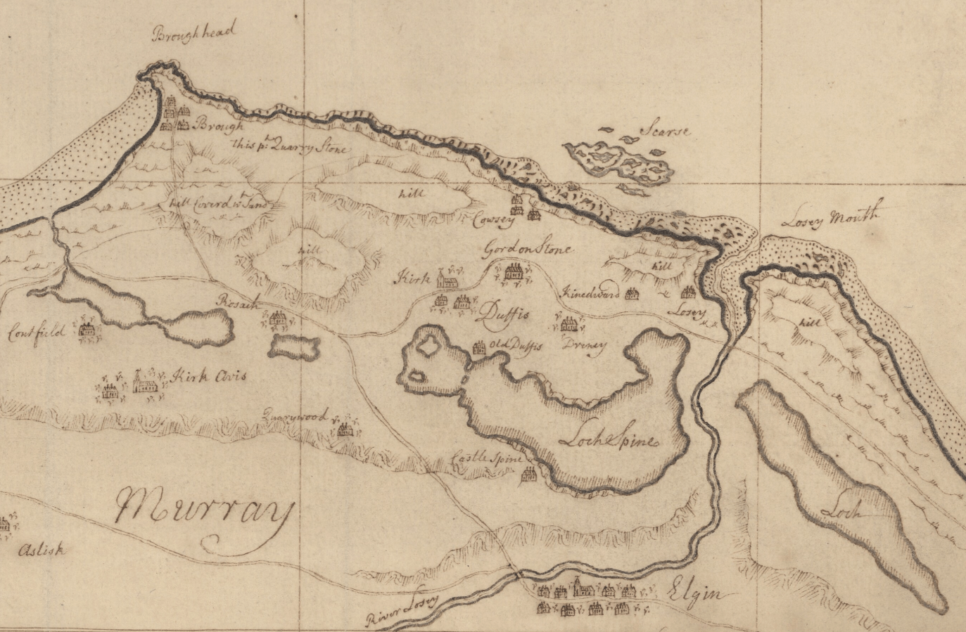
Image: Laich of Moray and Loch Spynie 1730
Size of this preview: 800 × 524 pixels. Other resolutions: 320 × 210 pixels | 1,373 × 899 pixels.
Original image (1,373 × 899 pixels, file size: 2.09 MB, MIME type: image/png)
Description: Military map of the Laich of Moray north of Elgin, showing the Loch of Roseisle, the Loch of Keam, Loch Spynie and the Loch of Cotts, collectively the remnants of the sea loch that earlier cut the Burghead, Duffus and Lossiemouth areas off from the mainland.
Title: Laich of Moray and Loch Spynie 1730
Credit: https://maps.nls.uk/military/rec/6
Author: Joseph Avery and George Wade
Usage Terms: Public domain
License: Public domain
Attribution Required?: No
Image usage
The following 2 pages link to this image:

All content from Kiddle encyclopedia articles (including the article images and facts) can be freely used under Attribution-ShareAlike license, unless stated otherwise.