
Image: Lake Bumbunga satellite view in summer
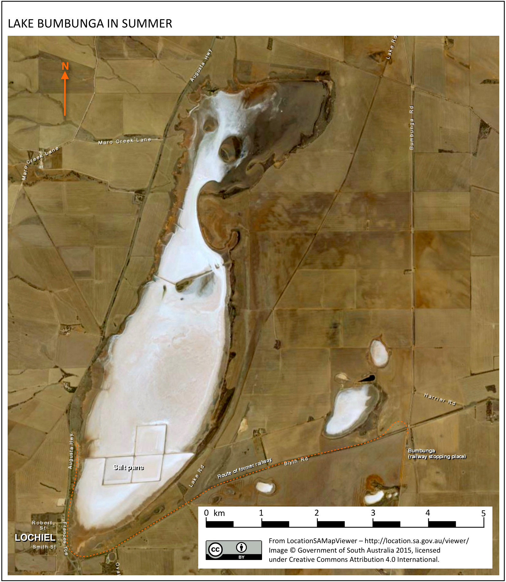
Description: A satellite image of Lake Bumbunga, a salt lake in the Mid North of South Australia adjacent to the small town of Lochiel, in summer, when water levels decline enabling salt to be harvested. The route of the former railway, which carried salt from the lake to Port Adelaide, is also shown.
Title: Lake Bumbunga satellite view in summer
Credit: LocationSAMapViewer – http://location.sa.gov.au/viewer/ – CC BY 4.0 International, to which I added text and a scale (CC0).
Author: Aerial image: Government of South Australia. Text and scale: SCHolar44.
Usage Terms: Creative Commons Attribution 4.0
License: CC BY 4.0
License Link: https://creativecommons.org/licenses/by/4.0
Attribution Required?: Yes
Image usage
The following page links to this image:
