
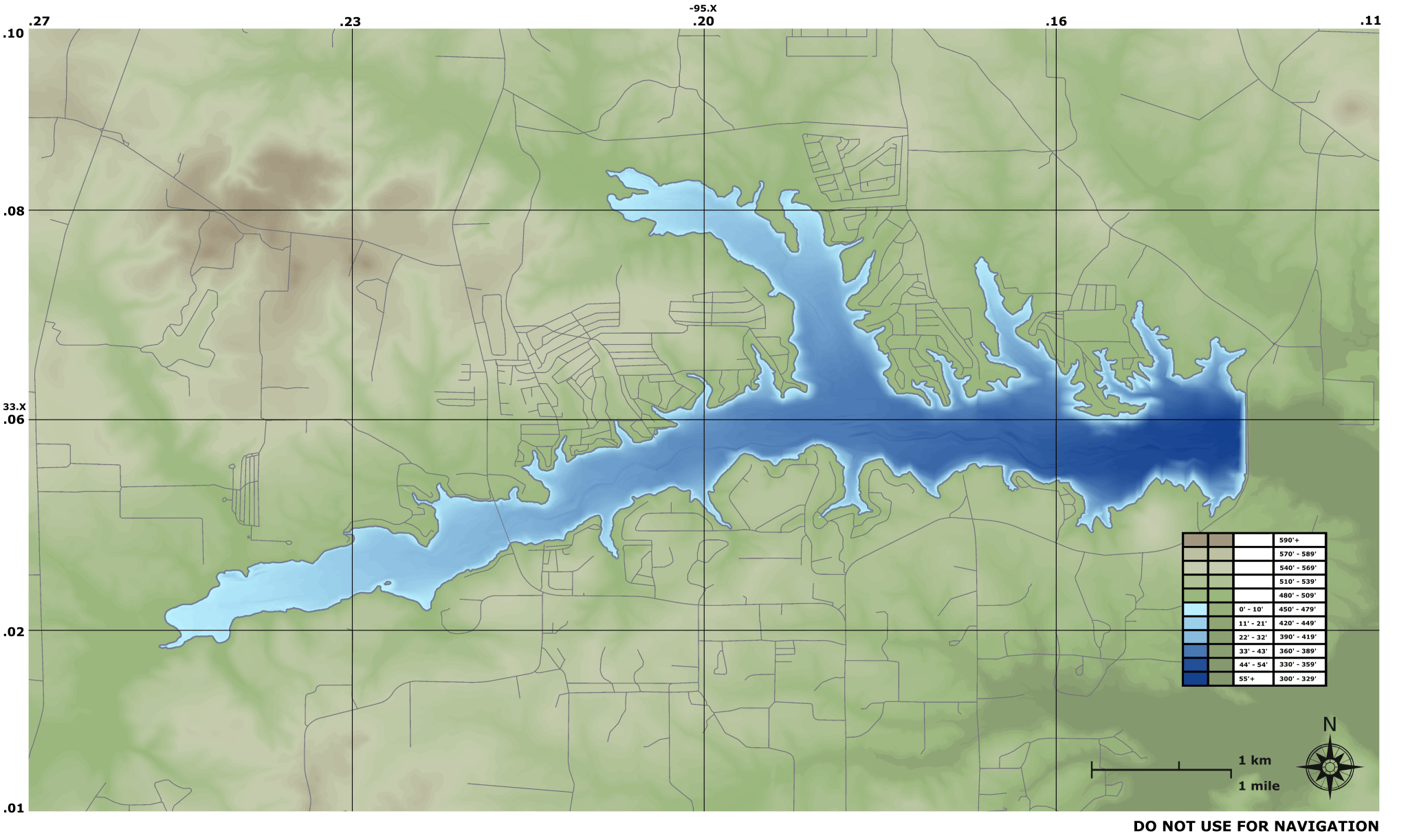
Image: Lake Cypress Springs Topographical Map
Description: This topographical map was generated using publicly available using a custom tool that I made and shaded based solely on elevation (not hillshaded). Although this map is fairly accurate, it does not include all roads that exist as of 2019. It also does not show ponds, small lakes, and the bathymetric map of Lake Bob Sandlin, which should be shown on the right side of the map beneath the dam. The latitude and longitude might be slightly off, and thus this map should not be used for navigation purposes. If you need this map released under a different license on another site or need a higher resolution, please get in touch with me and I can arrange that (the computing power required to create the map is more than my existing machine so I didn't put in the effort to generate it at this time).
Title: Lake Cypress Springs Topographical Map
Credit: Own work
Author: Maxup10
Usage Terms: Creative Commons Attribution-Share Alike 4.0
License: CC BY-SA 4.0
License Link: https://creativecommons.org/licenses/by-sa/4.0
Attribution Required?: Yes
Image usage
The following page links to this image:
