
Image: Last Island Map4
Size of this preview: 705 × 600 pixels. Other resolutions: 282 × 240 pixels | 1,000 × 851 pixels.
Original image (1,000 × 851 pixels, file size: 132 KB, MIME type: image/jpeg)
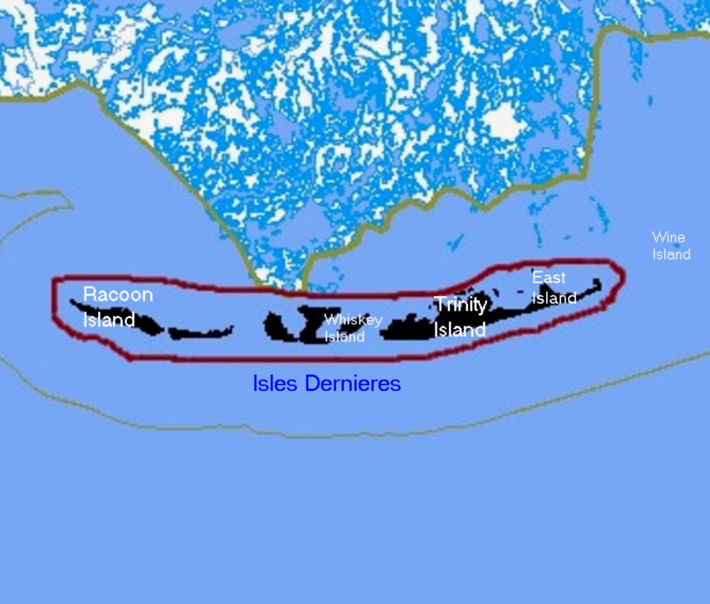
Description: Map of remaining portions of Last Island, Louisiana
Title: Last Island Map4
Credit: Map drawn by en:User:sf46 based on information gathered from U.S. Federal Government website: census.gov
Author: en:User:sf46
Permission: Released to public domain
Usage Terms: Public domain
License: Public domain
Attribution Required?: No
Image usage
The following page links to this image:

All content from Kiddle encyclopedia articles (including the article images and facts) can be freely used under Attribution-ShareAlike license, unless stated otherwise.