
Image: Lesser Prairie Chicken Tympanuchus pallidicinctus distribution map 3
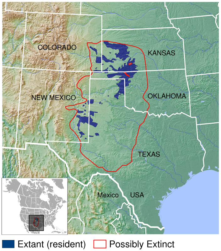
Description: Geographical distribution of the Lesser Prairie Chicken Tympanuchus pallidicinctus. The map was created using the Generic Mapping Tools, GMT, version 5.1.2.
Title: Lesser Prairie Chicken Tympanuchus pallidicinctus distribution map 3
Credit: source Own work using: the IUCN Red List spatial data to draw the borders of the Tympanuchus pallidicinctus range: http://maps.iucnredlist.org/map.html?id=22679519 Credit for the spatial data: BirdLife International and NatureServe (2014) Bird Species Distribution Maps of the World. 2012. Tympanuchus pallidicinctus. In: IUCN 2015. The IUCN Red List of Threatened Species. Version 2015.2. http://www.iucnredlist.org. Downloaded on 09 July 2015. Species account: http://www.iucnredlist.org/details/22679519/0 BirdLife International 2012. Tympanuchus pallidicinctus. The IUCN Red List of Threatened Species. Version 2015.2. <www.iucnredlist.org>. Downloaded on 09 July 2015. the following Public Domain datasets (grids) to draw the topography: GLOBE http://www.ngdc.noaa.gov/mgg/topo/gltiles.html. Credits: National Geophysical Data Center, 1999. Global Land One-kilometer Base Elevation (GLOBE) v.1. Hastings, D. and P.K. Dunbar. National Geophysical Data Center, NOAA. doi:10.7289/V52R3PMS [access date: 2015-03-16]. Created with Generic Mapping Tools (GMT)
Author: Darekk2 using the IUCN Red List spatial data and GLOBE grids
Usage Terms: Creative Commons Attribution-Share Alike 4.0
License: CC BY-SA 4.0
License Link: http://creativecommons.org/licenses/by-sa/4.0
Attribution Required?: Yes
Image usage
The following page links to this image:
