
Image: Little Blue River Battlefield Missouri
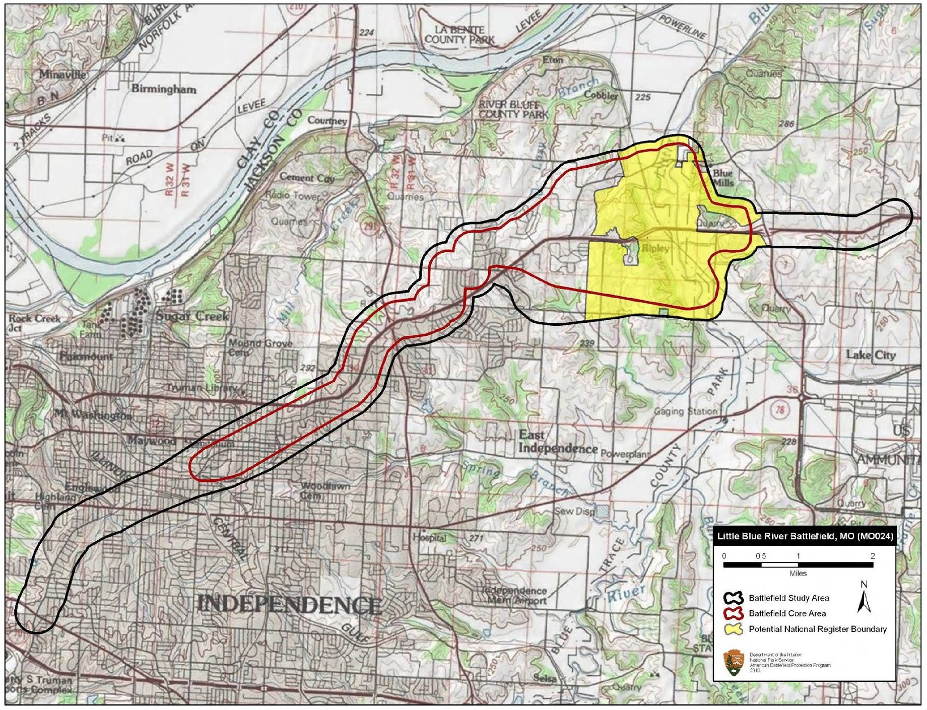
Description: Map of battlefield core and study areas. The ABPP expanded the 1993 Study Area to include the Confederate route of approach from the east, the point of initial contact between the opposing forces, the area of fighting across the Little Blue River, the area of fighting west of the river, areas of troop movements throughout the day, and the path of the fight to and through Independence. The ABPP was unable to identify the roads upon which Union forces completed their withdrawal toward Westport. The ABPP redrew the 1993 Core Area to represent more fully the day’s fighting. Included are 1) the location of the opening engagement east of the Little Blue River; 2) the sweep of fighting along and across the river; 3) the location of fighting across farmland to the west of the river; 4) the location where the Union battle line reformed once Blunt arrived on the field from Independence; 5) the area of the Union counterattack back toward the river; 6) the Confederate counterattack back to the west; 6) the fighting retreat made by of Union forces to Independence; and 7) the street fighting in town.
Title: Little Blue River Battlefield Missouri
Credit: National Park Service
Author: American Battlefield Protection Program
Usage Terms: Public domain
License: Public domain
Attribution Required?: No
Image usage
The following page links to this image:
