
Image: Lizars Mexico & Guatimala 1831 UTA (detail of British Territory--Balleze)
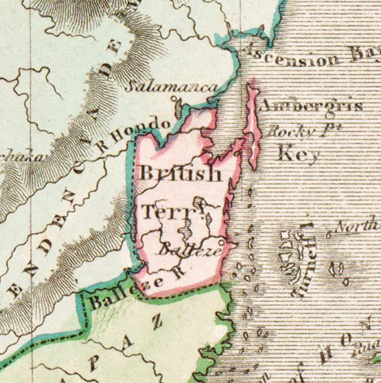
Description: The creator of this map was probably Daniel Lizars II (1793-1875), the son of Edinburgh map engraver and publisher Daniel Lizars I (1754-1812) and younger brother of William Home Lizars (1788-1859). Shortly after producing the map, Daniel II went bankrupt in 1832 and emigrated to Canada in 1833. Lizars' map shows Mexico's administrative districts as Intendencies (Intendencias) and Internal Provinces (Provincias Internas) dating from the Spanish era. His depiction of the area that became Texas is notably jarring to modern viewers because his map further exaggerated some of the cartographic errors of his predecessors and contemporaries: particularly, a southerly "dip" of the middle Red River and the southerly courses of the Trinity, Brazos, and Colorado Rivers (which actually flow southeasterly). Settlements shown include Nacogdoches, "St." Antonio, and "Loredo". Interestingly, Lizars included the "British Territory" that became British Honduras or Belize. British logging settlements existed in the territory by the late eighteenth century and, although the British government had been hesitant to create a colony for fear of provoking the Spanish, settlers there were largely self-governing.
Title: Mexico & Guatimala
Credit: UTA Libraries Cartographic Connections: map / text
Author: Daniel Lizars
Usage Terms: Public domain
License: Public domain
Attribution Required?: No
Image usage
The following page links to this image:

.jpg)