
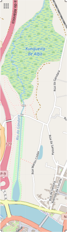
Image: Location Map Pontevedra Xunqueira de Alba
Size of this preview: 172 × 597 pixels. Other resolution: 220 × 764 pixels.
Original image (220 × 764 pixels, file size: 50 KB, MIME type: image/png)
Description: Geographic limits of the map: N: 42.4548° S: 42.4347° W: -8.6492° E: -8.4347°
Title: Location Map Pontevedra Xunqueira de Alba
Credit: https://www.openstreetmap.org/export#map=15/42.4447/-8.6444
Author: Geographic limits of the map: N: 42.4548° S: 42.4347° W: -8.6492° E: -8.6413°
Usage Terms: Creative Commons Attribution-Share Alike 4.0
License: CC BY-SA 4.0
License Link: https://creativecommons.org/licenses/by-sa/4.0
Attribution Required?: Yes
Image usage
The following page links to this image:

All content from Kiddle encyclopedia articles (including the article images and facts) can be freely used under Attribution-ShareAlike license, unless stated otherwise.