
Image: Location map Madrid
Size of this preview: 671 × 600 pixels. Other resolutions: 269 × 240 pixels | 901 × 805 pixels.
Original image (901 × 805 pixels, file size: 1.02 MB, MIME type: image/png)
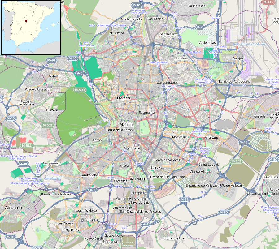
Description: Map of Madrid, Spain Geographic limits of the map: N: 40.522° S: 40.311° W: -3.843° E: -3.534°
Title: Location map Madrid
Credit: Maps for Free (OSM). Insert modificayion of File:Spain location map.svg
Author: Dr. Blofeld, insert originally by Nordnordwest
Usage Terms: Creative Commons Attribution-Share Alike 2.0
License: CC BY-SA 2.0
License Link: http://creativecommons.org/licenses/by-sa/2.0
Attribution Required?: Yes
Image usage
The following 2 pages link to this image:

All content from Kiddle encyclopedia articles (including the article images and facts) can be freely used under Attribution-ShareAlike license, unless stated otherwise.