
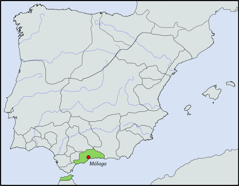
Image: Location map Taifa of Málaga

Size of this preview: 771 × 600 pixels. Other resolutions: 309 × 240 pixels | 2,000 × 1,556 pixels.
Original image (2,000 × 1,556 pixels, file size: 118 KB, MIME type: image/png)
Description: Location map Taifa of Málaga in 1037 (Tangier and Ceuta was part of this to 1068)
Title: Location map Taifa of Málaga
Credit: File:Location map Taifa of Málaga.svg
Author: Tyk
Usage Terms: Creative Commons Attribution-Share Alike 3.0
License: CC BY-SA 3.0
License Link: https://creativecommons.org/licenses/by-sa/3.0
Attribution Required?: Yes
Image usage
The following page links to this image:

All content from Kiddle encyclopedia articles (including the article images and facts) can be freely used under Attribution-ShareAlike license, unless stated otherwise.