
Image: Location map United Kingdom Borough of South Ribble

Size of this PNG preview of this SVG file: 800 × 583 pixels. Other resolution: 320 × 233 pixels.
Original image (SVG file, nominally 1,425 × 1,038 pixels, file size: 11.51 MB)
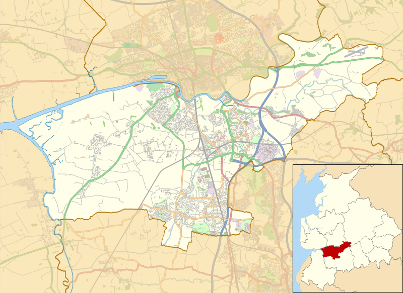
Description: Map of the Borough of South Ribble, Lancashire, England, in 2014. Equirectangular map projection on WGS 84 datum, with N/S stretched 165%
Geographic limits:
West: 2.87 W East: 2.53 W North: 53.80 N South: 53.65 N
Author: South Ribble UK ward map 2010 (blank).svg: Nilfanion, created using Ordnance Survey data OpenStreetMap: OpenStreetMap contributors
derivative work: Dr Greg
Usage Terms: Creative Commons Attribution-Share Alike 3.0
License: CC-BY-SA-3.0
License Link: http://creativecommons.org/licenses/by-sa/3.0/
Attribution Required?: Yes
Image usage
The following 2 pages link to this image:

All content from Kiddle encyclopedia articles (including the article images and facts) can be freely used under Attribution-ShareAlike license, unless stated otherwise.