
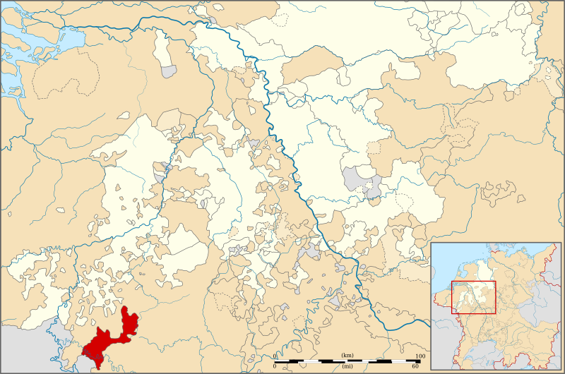
Image: Locator Principality of the Duchy of Boulion (1560)

Size of this PNG preview of this SVG file: 800 × 530 pixels. Other resolution: 320 × 212 pixels.
Original image (SVG file, nominally 5,029 × 3,330 pixels, file size: 576 KB)
Description: Locator map of the Duchy of Bouillon (1560)
Title: Locator map of the Duchy of Bouillon (1560)
Credit: Geschichtlicher Handatlas von Westfalen (1975)
Author: Sir Iain
Usage Terms: Creative Commons Attribution-Share Alike 3.0
License: CC BY-SA 3.0
License Link: https://creativecommons.org/licenses/by-sa/3.0
Attribution Required?: Yes
Image usage
The following image is a duplicate of this image (more details):
.svg)
The following page links to this image:

All content from Kiddle encyclopedia articles (including the article images and facts) can be freely used under Attribution-ShareAlike license, unless stated otherwise.
.svg)