
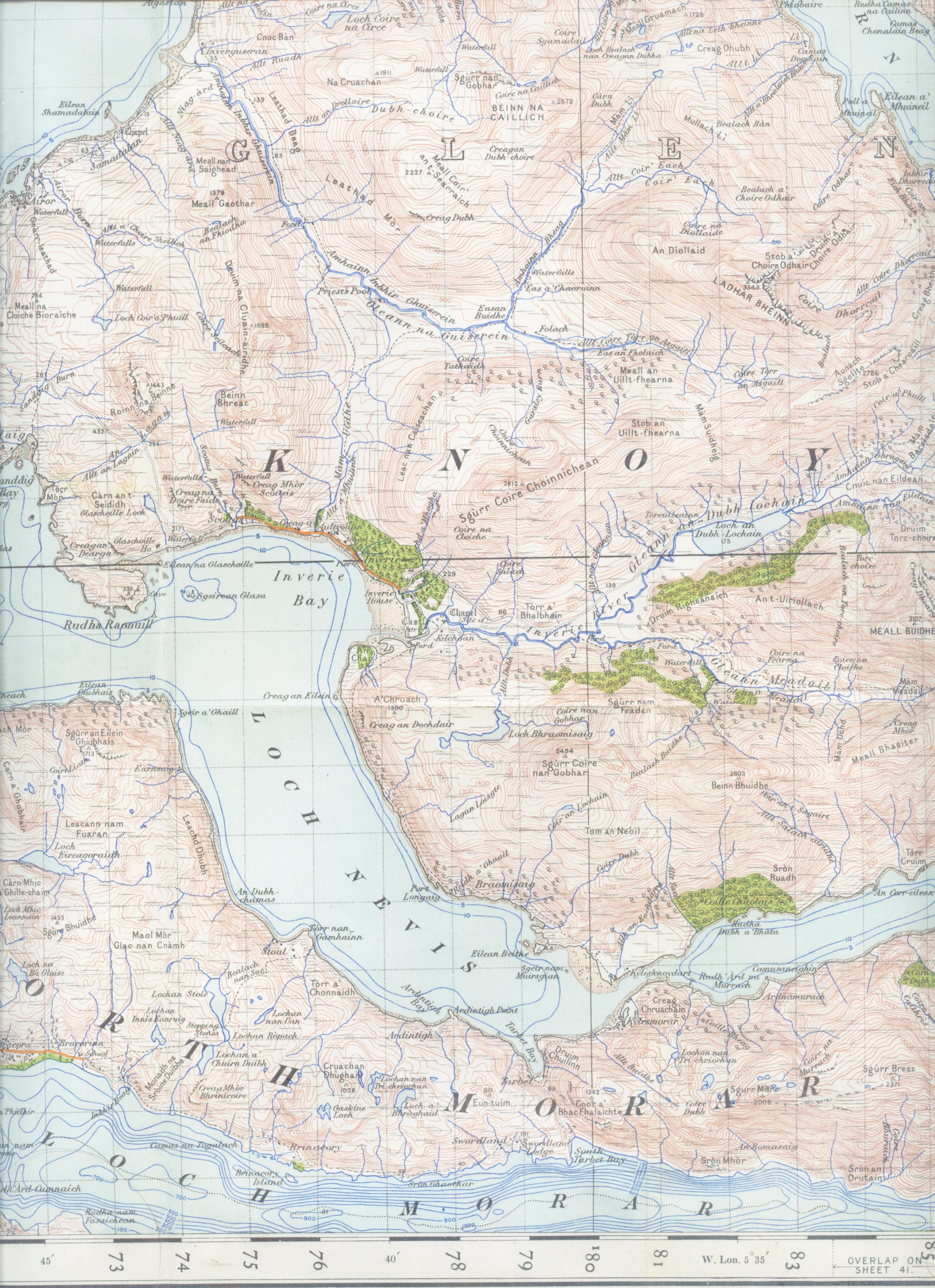
Image: Loch Nevisand surroundings map 1947
Size of this preview: 435 × 599 pixels. Other resolutions: 174 × 240 pixels | 2,544 × 3,504 pixels.
Original image (2,544 × 3,504 pixels, file size: 1.54 MB, MIME type: image/jpeg)
Description: Map of Loch Nevis and surroundings from 1947. Scale 1 inch to the mile 300DPI Sheet 35 "sound of sleat"
Title: Loch Nevisand surroundings map 1947
Credit: OS Sheet 35 "sound of sleat"
Author: OS
Usage Terms: Public domain
License: Public domain
Attribution Required?: No
Image usage
The following page links to this image:

All content from Kiddle encyclopedia articles (including the article images and facts) can be freely used under Attribution-ShareAlike license, unless stated otherwise.