
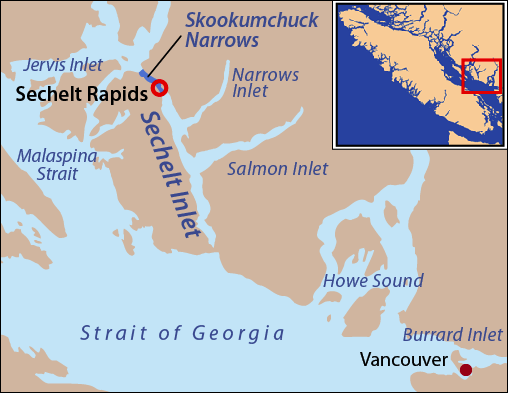
Image: Locmap-Sechelt2
No higher resolution available.
Locmap-Sechelt2.png (508 × 393 pixels, file size: 63 KB, MIME type: image/png)
Description: This is a locator map of Sechelt Inlet and Skookumchuck Narrows. I, Pfly, made it with ArcGIS, Adobe Illustrator, and Adobe Photoshop. The coastline data is from the Digital Chart of the World. Text enlarged from earlier version.
Title: Locmap-Sechelt2
Credit: Own work
Author: Pfly
Usage Terms: Creative Commons Attribution-Share Alike 4.0
License: CC BY-SA 4.0
License Link: https://creativecommons.org/licenses/by-sa/4.0
Attribution Required?: Yes
Image usage
The following 3 pages link to this image:

All content from Kiddle encyclopedia articles (including the article images and facts) can be freely used under Attribution-ShareAlike license, unless stated otherwise.