
Image: London Mayoral Election, 2012 by electoral wards
No higher resolution available.
London_Mayoral_Election,_2012_by_electoral_wards.png (504 × 391 pixels, file size: 54 KB, MIME type: image/png)
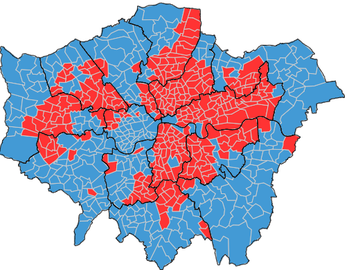
Description: Map illustrating the largest party by electoral ward in the election named above. Maps from a Greater London Authority dataset.
Title: London Mayoral Election, 2012 by electoral wards
Credit: data.london.gov.uk
Author: Greater London Authority
Usage Terms: Open Government License 2
License: OGL 2
License Link: http://www.nationalarchives.gov.uk/doc/open-government-licence/version/2
Attribution Required?: Yes
Image usage
The following page links to this image:

All content from Kiddle encyclopedia articles (including the article images and facts) can be freely used under Attribution-ShareAlike license, unless stated otherwise.