
Image: Long-tailed Ground Roller Range Map
No higher resolution available.
Long-tailed_Ground_Roller_Range_Map.png (400 × 324 pixels, file size: 12 KB, MIME type: image/png)
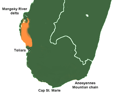
Description: Range of Uratelornis chimaera (orange) on a map of southern Madagascar
Title: Long-tailed Ground Roller Range Map
Credit: Own work based on: Seddon, Nathalie; Joseph A. Tobias (2007). "Population size and habitat associations of the Long-tailed Ground-roller Uratelornis chimaera". Bird Conservation International 17 (1): 1-12. Cambridge: BirdLife International. Archived from the original on 2013-12-17. Retrieved on 2012-04-05. Base map File:Madagascar spiny thickets.png
Author: Rufous-crowned Sparrow
Usage Terms: Creative Commons Attribution-Share Alike 3.0
License: CC BY-SA 3.0
License Link: http://creativecommons.org/licenses/by-sa/3.0/
Attribution Required?: Yes
Image usage
The following page links to this image:

All content from Kiddle encyclopedia articles (including the article images and facts) can be freely used under Attribution-ShareAlike license, unless stated otherwise.