
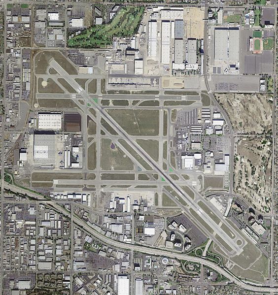
Image: Long Beach Airport - USGS 29 March 2004

Size of this preview: 564 × 599 pixels. Other resolutions: 226 × 240 pixels | 1,600 × 1,700 pixels.
Original image (1,600 × 1,700 pixels, file size: 599 KB, MIME type: image/jpeg)
Description: USGS digital orthophoto of Long Beach Airport in Long Beach, California, United States.
Title: Long Beach Airport - USGS 29 March 2004
Credit: USGS The National Map, via MSR Maps (formerly TerraServer-USA) Interactive map: http://msrmaps.com/map.aspx?t=4&s=12&lat=33.8175&lon=-118.1507&w=800&h=850 Image: http://msrmaps.com/GetImageArea.ashx?t=4&s=11&lat=33.8175&lon=-118.1507&w=1600&h=1700
Author: United States Geological Survey (USGS)
Permission: Public domain
Usage Terms: Public domain
License: Public domain
Attribution Required?: No
Image usage
The following page links to this image:

All content from Kiddle encyclopedia articles (including the article images and facts) can be freely used under Attribution-ShareAlike license, unless stated otherwise.