
Image: LongitudinalProfileGotthardtbahnAndTunnelSwitzerland
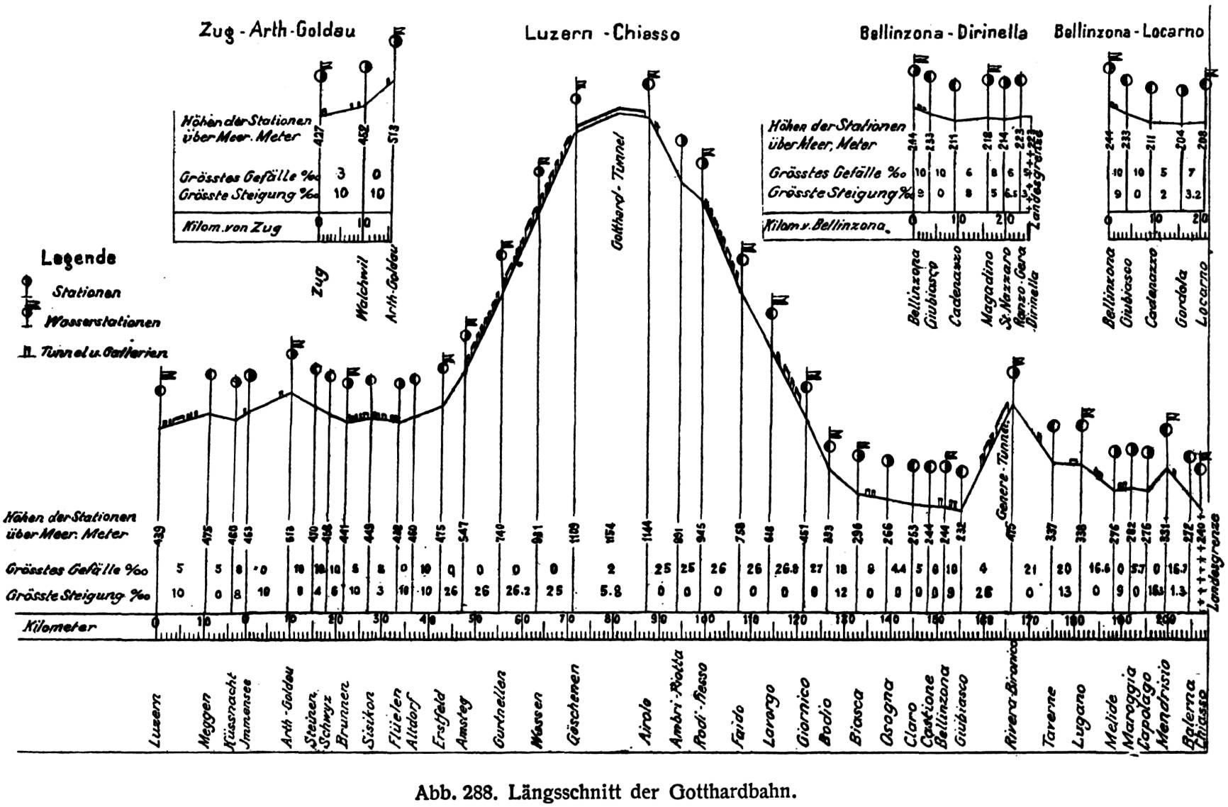
Description: Longitudinal profile of the Gotthardbahn from Luzern to Chiasso in Switzerland. The route elevation above sea level in [m] is shown above the travel distance from Luzern in [km] as linear interpolation between stations. Positions of stations, water stations, tunnels galleries and national borders are marked. The elevation of stations in [m] and steepest in- and decline of segments between stations are noted in [‰]. Branchlines from Zug to Arth-Goldau, from Bellinzona to Dirinella and from Bellinzona to Locarno are also shown.
Title: LongitudinalProfileGotthardtbahnAndTunnelSwitzerland
Credit: Gotthardbahn in: Röll, V. Freiherr von: Enzyklopädie des Eisenbahnwesens, Band 5. Berlin, Wien 1914, S. 354-361. digitized version on www.zeno.org/Roell-1912
Author: Dietler, Hermann (1839-10-01 - 1924-01-24); Röll, Victor Freiherr von (1852-05-22 - 1922-10-12)
Permission: This work is in the public domain in its country of origin and other countries and areas where the copyright term is the author's life plus 80 years or less. You must also include a United States public domain tag to indicate why this work is in the public domain in the United States. Note that a few countries have copyright terms longer than 80 years: Mexico has 100 years, Jamaica has 95 years. This image may not be in the public domain in these countries, which moreover do not implement the rule of the shorter term. Côte d'Ivoire has a general copyright term of 99 years, but it does implement the rule of the shorter term. This file has been identified as being free of known restrictions under copyright law, including all related and neighboring rights.
Usage Terms: Public domain
License: Public domain
Attribution Required?: No
Image usage
The following 2 pages link to this image:
