
Image: Lord Howe Island 1952 map

Size of this preview: 455 × 599 pixels. Other resolutions: 182 × 240 pixels | 4,513 × 5,942 pixels.
Original image (4,513 × 5,942 pixels, file size: 15.55 MB, MIME type: image/jpeg)
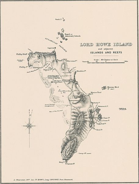
Description: Lord Howe Island lower right inset of Map of New South Wales including Lord Howe Island, showing land districts and land board districts and administrative districts (Western Division) . Southeastern sheet of four map sheets,
Title: Lord Howe Island 1952 map
Credit: http://nla.gov.au/nla.obj-466252912/view (crop)
Author: New South Wales. Department of Lands
Usage Terms: Public domain
License: Public domain
Attribution Required?: No
Image usage
The following page links to this image:

All content from Kiddle encyclopedia articles (including the article images and facts) can be freely used under Attribution-ShareAlike license, unless stated otherwise.