
Image: Loughton, A121 High Road - geograph.org.uk - 549251
No higher resolution available.
Loughton,_A121_High_Road_-_geograph.org.uk_-_549251.jpg (640 × 480 pixels, file size: 131 KB, MIME type: image/jpeg)
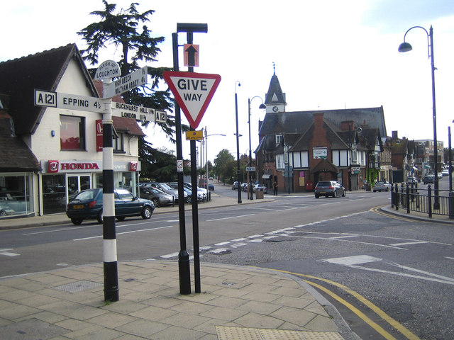
Description: Loughton: A121 High Road Loughton Parish Council are rightly proud of their traditional finger post road signs. This one at the junction of the High Road with Station Road and Forest Road tells us the following mileages:- Epping 4½, Buckhurst Hill 1¾, London 11¾, High Beech 1½, and Waltham Abbey 4¼. Lopping Hall 548944 is the building with the clock tower in the distance.
Title: Loughton, A121 High Road - geograph.org.uk - 549251
Credit: From geograph.org.uk
Author: Nigel Cox
Usage Terms: Creative Commons Attribution-Share Alike 2.0
License: CC BY-SA 2.0
License Link: https://creativecommons.org/licenses/by-sa/2.0
Attribution Required?: Yes
Image usage
The following page links to this image:

All content from Kiddle encyclopedia articles (including the article images and facts) can be freely used under Attribution-ShareAlike license, unless stated otherwise.