
Image: Lovejoy's Station Battlefield Georgia
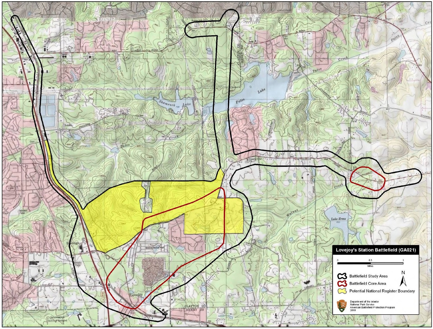
Description: Map of battlefield core and study areas. The ABPP completely redrew the 1993 boundaries for Lovejoy’s Station. The new Study Area gives a more complete picture of the Federal approach from the northeast toward Lovejoy’s Station, and the Confederate response along the Macon & Western Railroad. The Study Area was expanded to the east to include the fighting at Nash Farm and the rearguard action at Walnut Creek. The Core Areas for both of those engagements were delineated based on recent archaeological studies.
Title: Lovejoy's Station Battlefield Georgia
Credit: National Park Service
Author: American Battlefield Protection Program
Usage Terms: Public domain
License: Public domain
Attribution Required?: No
Image usage
The following page links to this image:
