
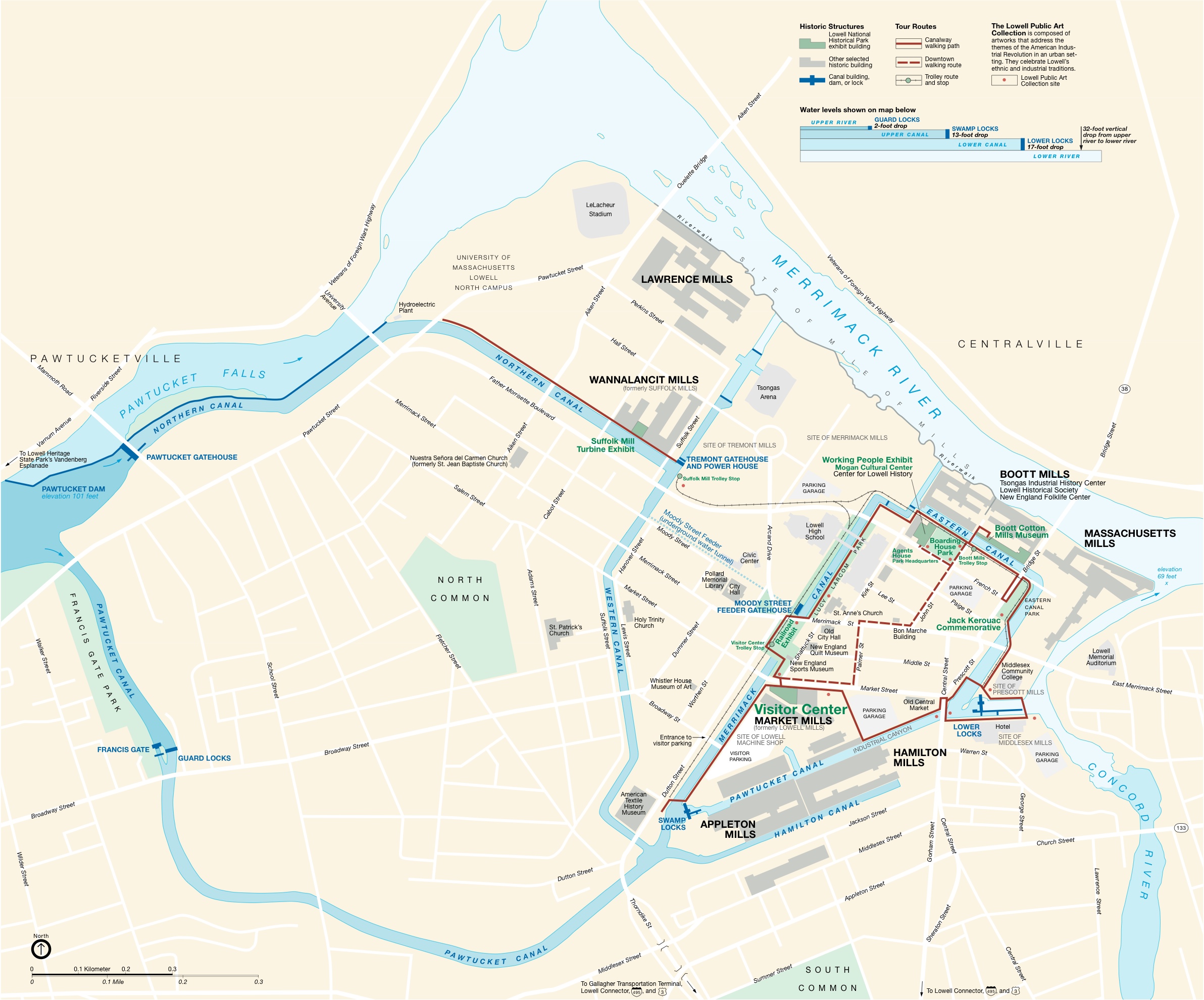
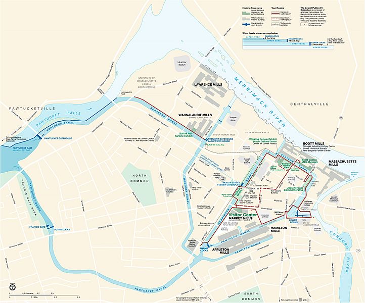
Image: Lowell National Historical Park Official Map
Size of this preview: 722 × 600 pixels. Other resolutions: 289 × 240 pixels | 2,384 × 1,980 pixels.
Original image (2,384 × 1,980 pixels, file size: 917 KB, MIME type: image/jpeg)
Description: National Park Service map of the Lowell National Historical Park — in Lowell, Massachusetts.
Title: Lowell National Historical Park Official Map
Credit: National Park Service
Author: National Park Service
Usage Terms: Public domain
License: Public domain
Attribution Required?: No
Image usage
The following page links to this image:

All content from Kiddle encyclopedia articles (including the article images and facts) can be freely used under Attribution-ShareAlike license, unless stated otherwise.