
Image: Lower Earley, 1982 - geograph.org.uk - 1438135
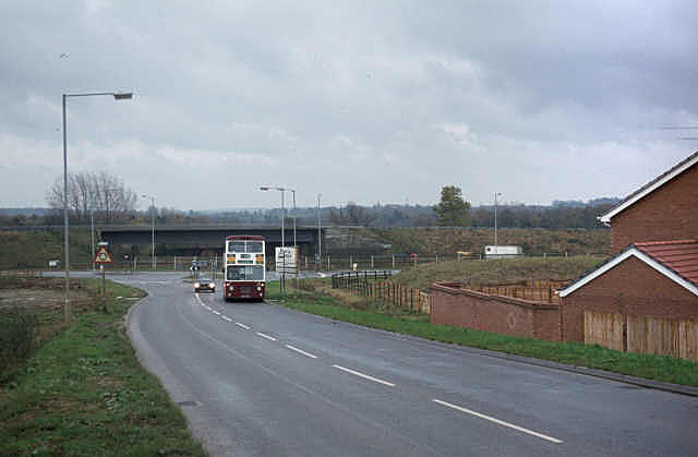
Description: Lower Earley, 1982, near to Shinfield, Wokingham, Great Britain. At this stage the area was still very much under development. This is the bottom of Beeston Way at its junction with Lower Earley Way. The bridge in the background was built to carry Cutbush Lane over the M4; it was relegated to foot and cycle traffic with the development of Lower Earley Way as a major local distributor road.
Title: Lower Earley, 1982 - geograph.org.uk - 1438135
Credit: From geograph.org.uk; transferred by User:Baldboris99 using geograph_org2commons.
Author: Alan Murray-Rust
Permission: Creative Commons Attribution Share-alike license 2.0
Usage Terms: Creative Commons Attribution-Share Alike 2.0
License: CC BY-SA 2.0
License Link: https://creativecommons.org/licenses/by-sa/2.0
Attribution Required?: Yes
Image usage
The following page links to this image:
