
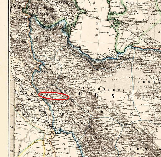
Image: Luristan 1875

Size of this preview: 616 × 600 pixels. Other resolutions: 247 × 240 pixels | 972 × 946 pixels.
Original image (972 × 946 pixels, file size: 538 KB, MIME type: image/jpeg)
Description: Luristan 1875
Title: Luristan 1875
Credit: Steel engraving, hand colored in outline when published. Detailed antique map of Persia, Afghanistan, Balutschistan and Turkestan. This antique map provides detailed information on place names, rivers, deserts, mountains and regional borders. Table of explanation of the political possessions with the various color codes in the lower right corner.
Author: Petermann, A
Usage Terms: Public domain
License: Public domain
Attribution Required?: No
Image usage
The following page links to this image:

All content from Kiddle encyclopedia articles (including the article images and facts) can be freely used under Attribution-ShareAlike license, unless stated otherwise.