
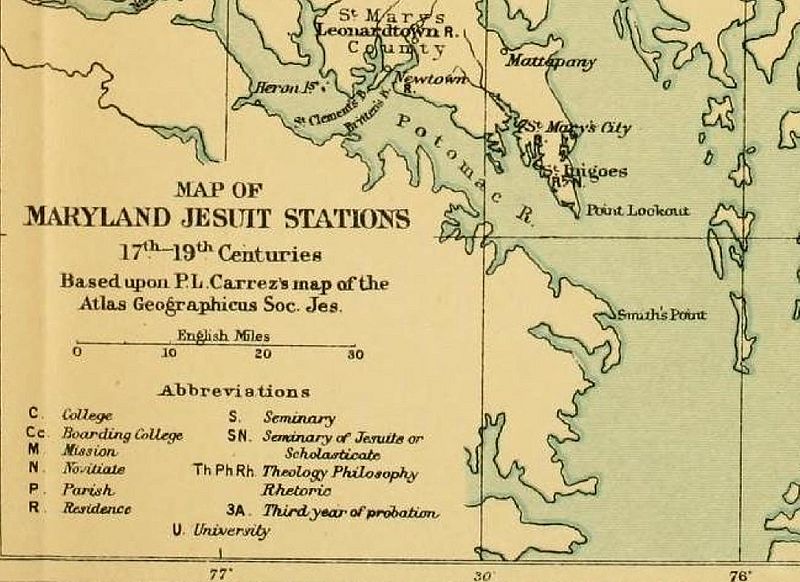
Image: MAP OF MARYLAND JESUIT STATIONS, 17TH-19TH CENTURIES (with St. Inigoes close-up)

Size of this preview: 800 × 582 pixels. Other resolutions: 320 × 233 pixels | 2,027 × 1,474 pixels.
Original image (2,027 × 1,474 pixels, file size: 353 KB, MIME type: image/jpeg)
Description: A map of Jesuit stations in Maryland from the 17th to the 19th centuries, showing the locations of Jesuit plantations, farms, and schools, including Bohemia, Frederick, Georgetown, Leonardtown, Newtown, Port Tobacco, St. Inigoes, St. Joseph, St. Thomas, Wshington, White Marsh, and Woodstock.
Title: MAP OF MARYLAND JESUIT STATIONS, 17TH-19TH CENTURIES (with St. Inigoes close-up)
Credit: Georgetown Slavery Archive https://slaveryarchive.georgetown.edu/items/show/57
Author: Georgetown Slavery Archive
Usage Terms: Public domain
License: Public domain
Attribution Required?: No
Image usage
The following page links to this image:

All content from Kiddle encyclopedia articles (including the article images and facts) can be freely used under Attribution-ShareAlike license, unless stated otherwise.
.jpg)