
Image: M 6.7 - 9km NNE of Doganyol, Turkey

Size of this preview: 535 × 599 pixels. Other resolutions: 214 × 240 pixels | 917 × 1,027 pixels.
Original image (917 × 1,027 pixels, file size: 403 KB, MIME type: image/jpeg)
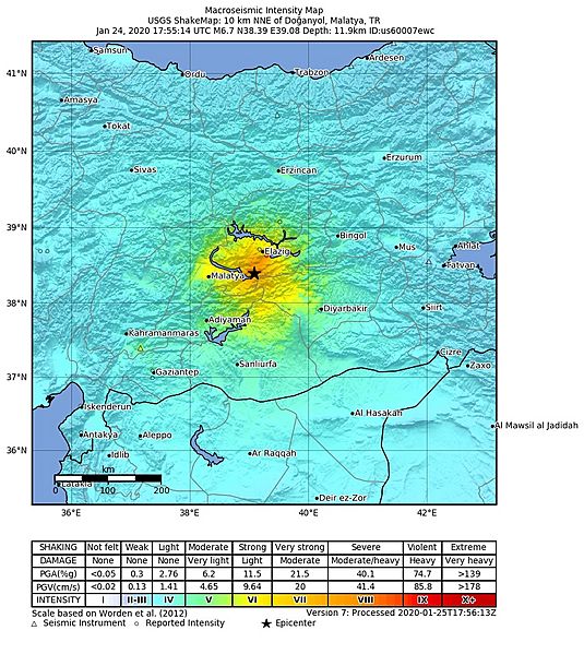
Description: Mapa de intensidades Mercalli del Terremoto de Turquía del 24 de enero de 2020
Title: M 6.7 - 9km NNE of Doganyol, Turkey
Credit: https://earthquake.usgs.gov/earthquakes/eventpage/us60007ewc/shakemap/intensity
Author: USGS
Usage Terms: Creative Commons Zero, Public Domain Dedication
License: CC0
License Link: http://creativecommons.org/publicdomain/zero/1.0/deed.en
Attribution Required?: No
Image usage
The following page links to this image:

All content from Kiddle encyclopedia articles (including the article images and facts) can be freely used under Attribution-ShareAlike license, unless stated otherwise.