
Image: Main towns in the province of Valencia
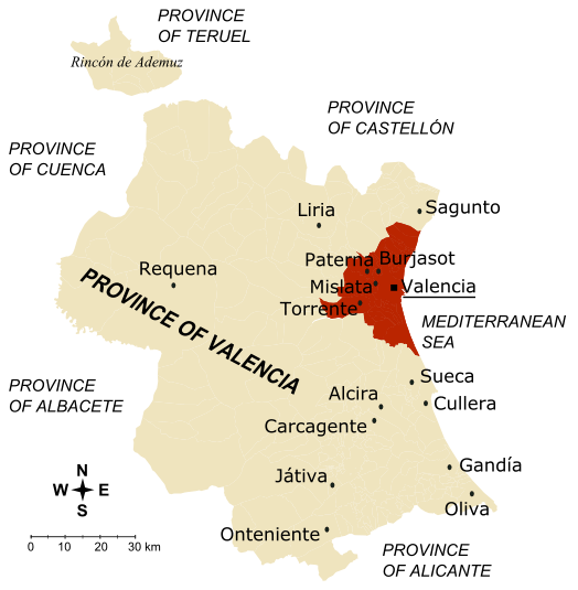
Description: Map of the province of Valencia (Spain) The inner city and the towns conforming the first crown of Valencia metropolitan area are drawn in dark brown; together, they concentrate 60.62% of the province population in 5.73% of its surface, with a mean density of 2.407 hab/km2. The towns marked on the map are those with more than 30,000 inhabitantes (if they belong to Valencia metropolitan area) or more than 20,000 inhabitants (for the rest of towns), according to 2005 census. Author: Rodriguillo Realised from: Image:Valencia - Mapa municipal.svg Other versions: español, français
Title: Main towns in the province of Valencia
Credit: No machine-readable source provided. Own work assumed (based on copyright claims).
Author: No machine-readable author provided. Rodriguillo assumed (based on copyright claims).
Usage Terms: Public domain
License: Public domain
Attribution Required?: No
Image usage
The following page links to this image:
