
Image: Manukau Harbour surveyed by Commander B. Drury ... (et al.), 1853 - Mangere Bridge cropped
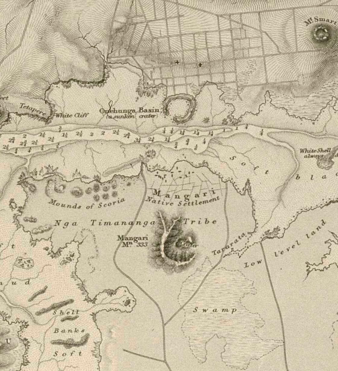
Description: Cropped section of Manukau Harbour / surveyed by Commander B. Drury ... [et al.], 1853 ; drawn by Edward J. Powell ; engraved by J.& C. Walker., showing Mangere Bridge and Onehunga. Manukau Harbour / surveyed by Commander B. Drury ... [et al.], 1853 ; drawn by Edward J. Powell ; engraved by J.& C. Walker. At head of title: New Zealand, North Island, west coast Great Britain. Hydrographic Office J. & C. Walker (Firm) Manukau Harbour (N.Z.) -- Maps Scale 1:48,600 London : Hydrographic Office of the Admiralty 1860 NLNZ ALMA 9918217372402836
Title: Manukau Harbour surveyed by Commander B. Drury ... (et al.), 1853 - Mangere Bridge cropped
Credit: https://natlib-primo.hosted.exlibrisgroup.com/primo-explore/fulldisplay?vid=NLNZ&docid=NLNZ_ALMA21315082300002836&context=L&search_scope=NLNZ
Author: Drawn by Edward J. Powell ; engraved by J.& C. Walker. Published by the Hydrographic Office of Great Britain.
Usage Terms: Public domain
License: Public domain
Attribution Required?: No
Image usage
The following page links to this image:

,_1853_-_Mangere_Bridge_cropped.jpg)