
Image: Mao Kun map - Pahang, Pulau Tioman
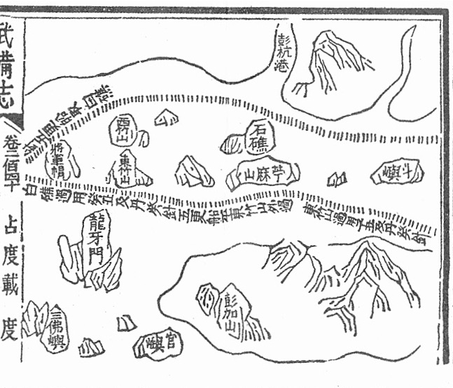
Description: Mao Kun map showing part of the east coast of Malaysia. Marked on the map are Pulau Tinggi (將軍帽), Pulau Aur (東竹山 and 西竹山), Pahang River estuary (彭杭港), Pulau Siribuat (石礁), Pulau Tioman (苧麻山) and Pulau Tenggol (斗嶼).
Title: Mao Kun map - Pahang, Pulau Tioman
Credit: Scanned from Scanned from Paul Wheatley (1961) The Golden Khersonese: Studies in the Historical Geography of the Malay Peninsula before A.D. 1500, Kuala Lumpur: University of Malaya Press OCLC: 504030596. Originally from the Wubei Zhi, a 17th century work with maps based on material dated to the voyages of Zheng He.
Author: Mao Yuanyi (1594–1640?), editor of the Wubei Zhi; and an unknown cartographer.
Usage Terms: Public domain
License: Public domain
Attribution Required?: No
Image usage
The following page links to this image:
