
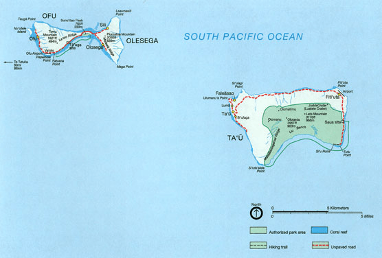
Image: MapOfManua NPS
No higher resolution available.
MapOfManua_NPS.png (556 × 376 pixels, file size: 128 KB, MIME type: image/png)
Description: NPS map of Manuʻa Islands, American Samoa
Title: MapOfManua NPS
Credit: http://www.nps.gov/npsa/planyourvisit/maptaugif.htm
Author: NPS, converted into .png by Telim tor
Usage Terms: Public domain
License: Public domain
Attribution Required?: No
Image usage
The following page links to this image:

All content from Kiddle encyclopedia articles (including the article images and facts) can be freely used under Attribution-ShareAlike license, unless stated otherwise.