
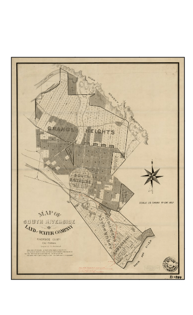
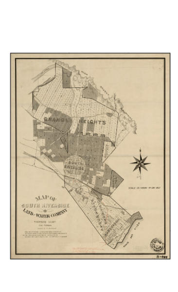
Image: MapSouthRiversideLandandWate Company1890
Size of this preview: 366 × 599 pixels. Other resolutions: 147 × 240 pixels | 390 × 638 pixels.
Original image (390 × 638 pixels, file size: 307 KB, MIME type: image/png)
Description: Map of the South Riverside Land and Water Company in 1890. Now City of Corona
Title: MapSouthRiversideLandandWate Company1890
Credit: Original publication: 1890 Immediate source: blob:null/1a7c7d49-de13-4d3b-822a-297d87bb3806
Author: South Riverside Land and Water Company (Life time: 1890)
Usage Terms: Public domain in the United States
License: PD-US-expired
License Link: //en.wikipedia.org/wiki/File:MapSouthRiversideLandandWate_Company1890.png
Image usage
The following page links to this image:

All content from Kiddle encyclopedia articles (including the article images and facts) can be freely used under Attribution-ShareAlike license, unless stated otherwise.