
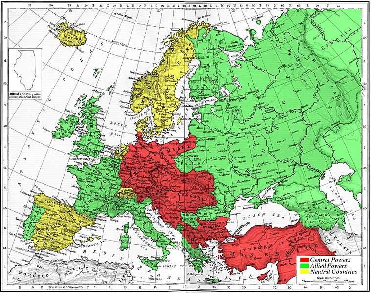
Image: Map 1914 WWI Alliances

Description: Map of Europe's alliances in 1915. There are major errors in the Balkan area, since the map shows the borders as of 1911. After the Balkan Wars the borders changed significantly. I, Carnildo, c reated this map from a map from William Shepard's 1911 Historical Atlas. The original map was downloaded from the University of Texas' Perry-Castañeda Library map collection, URL http://www.lib.utexas.edu/maps/historical/shepherd_1911/shepherd-c-166-167.jpg. The GIMP-native image file for this image may be found at en:Image:Europe-WWI.xcf. It is recommended that anyone editing this map work with the .xcf version.
Title: Map 1914 WWI Alliances
Credit: No machine-readable source provided. Own work assumed (based on copyright claims).
Author: No machine-readable author provided. Knutux assumed (based on copyright claims).
Usage Terms: Public domain
License: Public domain
Attribution Required?: No
Image usage
The following page links to this image:
