
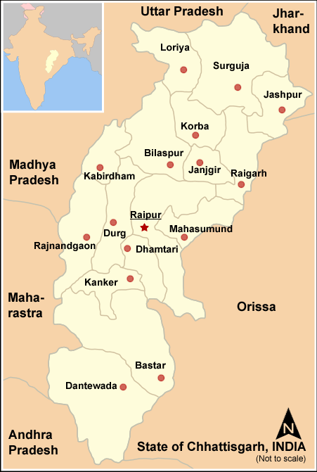
Image: Map Chhattisgarh state and districts
Size of this preview: 403 × 600 pixels. Other resolutions: 161 × 240 pixels | 451 × 671 pixels.
Original image (451 × 671 pixels, file size: 32 KB, MIME type: image/png)
Description: Chhattisgarh State (India) with district boundries and city marks - Self Made - w:User:Miljoshi - Jan 2006 Note: co-ordinates are estimated, and may not be exactly accurate.
Title: Map Chhattisgarh state and districts
Credit: No machine-readable source provided. Own work assumed (based on copyright claims).
Author: No machine-readable author provided. Miljoshi assumed (based on copyright claims).
Usage Terms: Creative Commons Attribution-Share Alike 3.0
License: CC-BY-SA-3.0
License Link: http://creativecommons.org/licenses/by-sa/3.0/
Attribution Required?: Yes
Image usage
There are no pages that link to this image.

All content from Kiddle encyclopedia articles (including the article images and facts) can be freely used under Attribution-ShareAlike license, unless stated otherwise.