
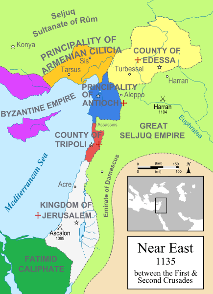
Image: Map Crusader states 1135-en

Size of this PNG preview of this SVG file: 435 × 599 pixels. Other resolution: 174 × 240 pixels.
Original image (SVG file, nominally 955 × 1,315 pixels, file size: 418 KB)
Description: A political map of the Near East in 1135 CE. Crusader states are marked with a red cross.
Author: MapMaster
Usage Terms: Creative Commons Attribution-Share Alike 3.0
License: CC-BY-SA-3.0
License Link: http://creativecommons.org/licenses/by-sa/3.0/
Attribution Required?: Yes
Image usage
The following 7 pages link to this image:

All content from Kiddle encyclopedia articles (including the article images and facts) can be freely used under Attribution-ShareAlike license, unless stated otherwise.