
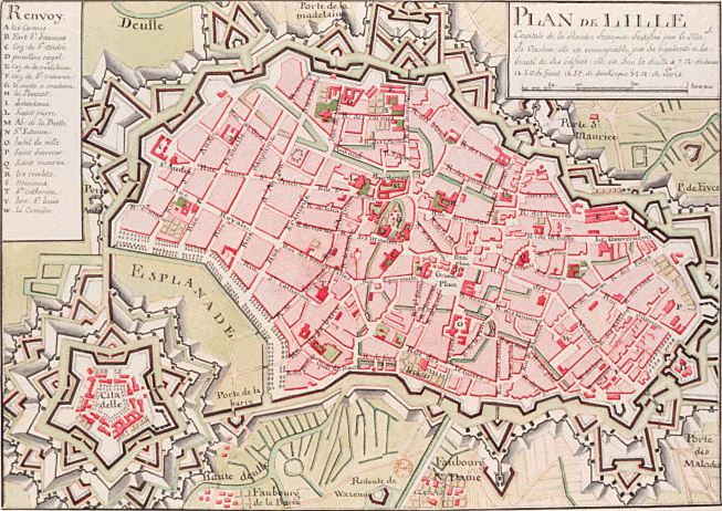
Image: Map Vieux Lille Vauban
No higher resolution available.
Map_Vieux_Lille_Vauban.png (653 × 462 pixels, file size: 260 KB, MIME type: image/png)
Description: Carte du vieux Lille et de la citadelle Vauban (publication du XVIIIe siècle) Origine de l'image : Gallica (Notice n° : FRBNF38646965)
Title: Map Vieux Lille Vauban
Credit: Transferred from fr.wikipedia to Commons by Coyau using CommonsHelper.
Author: The original uploader was FoeNyx at French Wikipedia
Usage Terms: Public domain
License: Public domain
Attribution Required?: No
Image usage
There are no pages that link to this image.

All content from Kiddle encyclopedia articles (including the article images and facts) can be freely used under Attribution-ShareAlike license, unless stated otherwise.