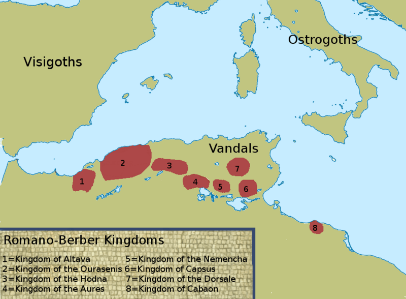
Image: Map depicting the Romano-Berber Kingdoms

Size of this preview: 800 × 588 pixels. Other resolutions: 320 × 235 pixels | 900 × 662 pixels.
Original image (900 × 662 pixels, file size: 98 KB, MIME type: image/png)
Description: This is a selfmade copy based on figure 4.2 from the book "Vandals, Romans and Berbers: New Perspectives on Late Antique North Africa" by A.H. Merrills. Originally it is from Christian Curtois' "Les Vandales et l'Afrique", p. 334. It depicts the eight Christianized Romano-Berber states during the sixth century. Based on NordNordWest's "Mediterranean Sea location map (blank)"
Title: Map depicting the Romano-Berber Kingdoms
Credit: Own work
Author: LeGabrie
Usage Terms: Creative Commons Attribution-Share Alike 4.0
License: CC BY-SA 4.0
License Link: https://creativecommons.org/licenses/by-sa/4.0
Attribution Required?: Yes
Image usage
The following page links to this image:

All content from Kiddle encyclopedia articles (including the article images and facts) can be freely used under Attribution-ShareAlike license, unless stated otherwise.
