
Image: Map of Øresund new version

Size of this preview: 454 × 599 pixels. Other resolutions: 182 × 240 pixels | 465 × 614 pixels.
Original image (465 × 614 pixels, file size: 71 KB, MIME type: image/jpeg)
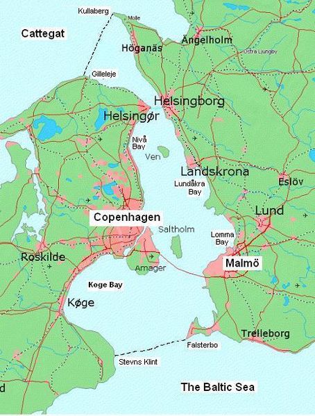
Description: An improved map of Øresund. Made from an existing one found on Wikimedia Commons. Improvements are - boundaries in both north and south, boundary landmarks labeled, no "Ö-letter" in Denmark. Copenhagen spelled in English. Four bays labeled. Also, there is no fixed connection in the north and most narrow part, but ferries. Towns and cities have grown since original map was made. Western Amager is NOT buld up. Cattegat and the Baltic Sea written on the map.
Title: Map of Øresund new version
Credit: Own work
Author: Boeing720
Usage Terms: Creative Commons Attribution-Share Alike 4.0
License: CC BY-SA 4.0
License Link: https://creativecommons.org/licenses/by-sa/4.0
Attribution Required?: Yes
Image usage
The following page links to this image:

All content from Kiddle encyclopedia articles (including the article images and facts) can be freely used under Attribution-ShareAlike license, unless stated otherwise.