
Image: Map of Arabic speaking localities in Israel
Size of this preview: 373 × 599 pixels. Other resolutions: 149 × 240 pixels | 4,773 × 7,667 pixels.
Original image (4,773 × 7,667 pixels, file size: 693 KB, MIME type: image/png)
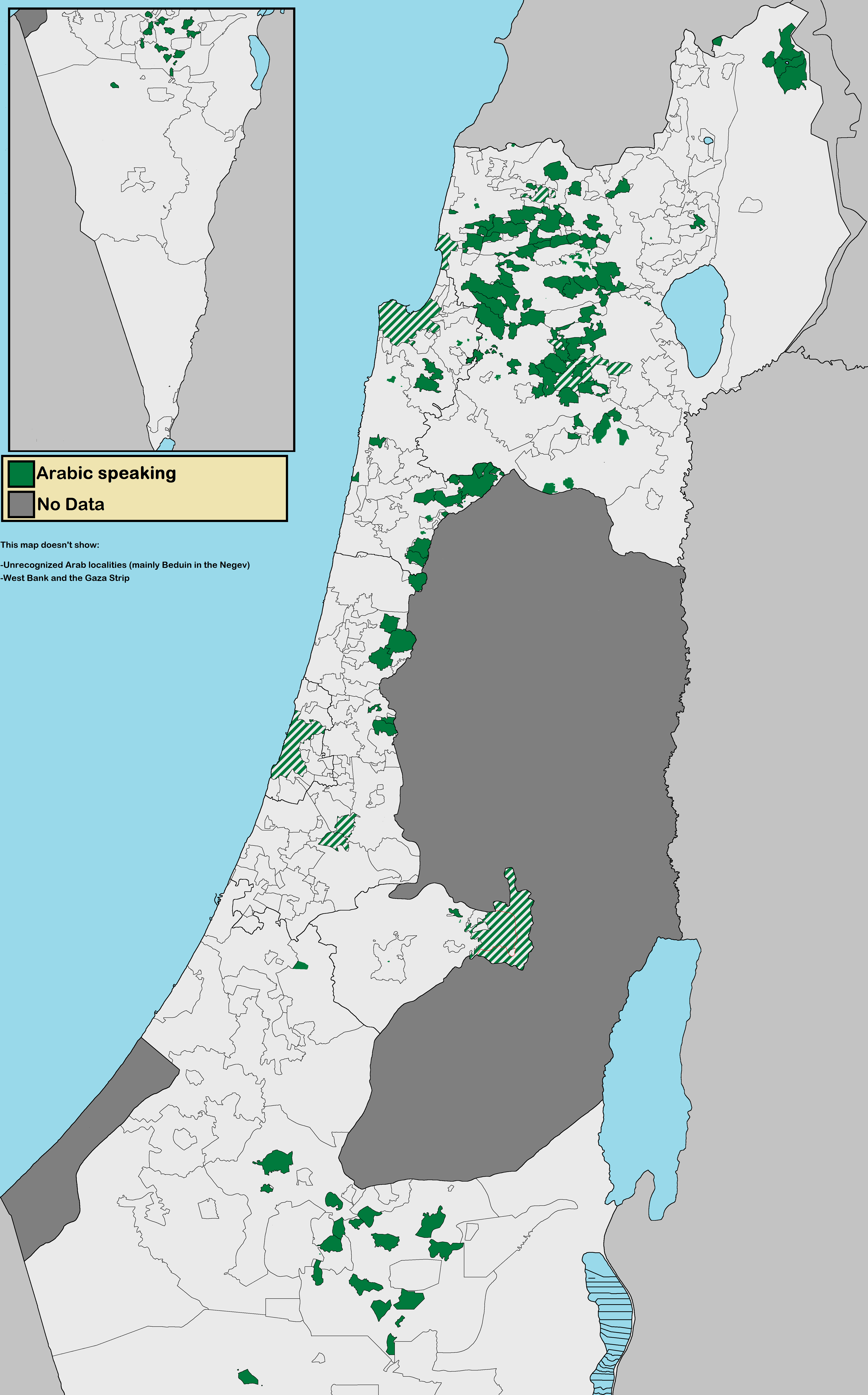
Description: This is a map of all the Arabic speaking localities in the State of Israel (including East Jerusalem and the Golan Heights). Striped represent officially mixed cities (by law, at least 2% Arabs in a Jewish majority city). Note: Jerusalem is officially a mixed city but the map shows the boundries of Arab and Jewish neighborhoods.
Title: Map of Arabic speaking localities in Israel
Credit: Own work Map is based on [1] and [2]. Data from [3]
Author: Bolter21
Usage Terms: Creative Commons Attribution-Share Alike 4.0
License: CC BY-SA 4.0
License Link: https://creativecommons.org/licenses/by-sa/4.0
Attribution Required?: Yes
Image usage
There are no pages that link to this image.

All content from Kiddle encyclopedia articles (including the article images and facts) can be freely used under Attribution-ShareAlike license, unless stated otherwise.